A scramble up Helvellyn and Catstye Cam via Striding Edge and Swirral Edge, voted one of the most popular walks in the Lake District, England.
Helvellyn
Helvellyn is a mountain in the Lake District. At 3,117 feet (950 metres), it is the third largest peak in England and the highest point of the Helvellyn range, a north–south line of mountains to the north of Ambleside, between the lakes of Thirlmere and Ullswater.
Depending on your fitness level, there are several different routes to the summit. For our ascent, my friend and I opted for the classic horseshoe walk, taking in Striding Edge, Swirral Edge and Catstye Cam.
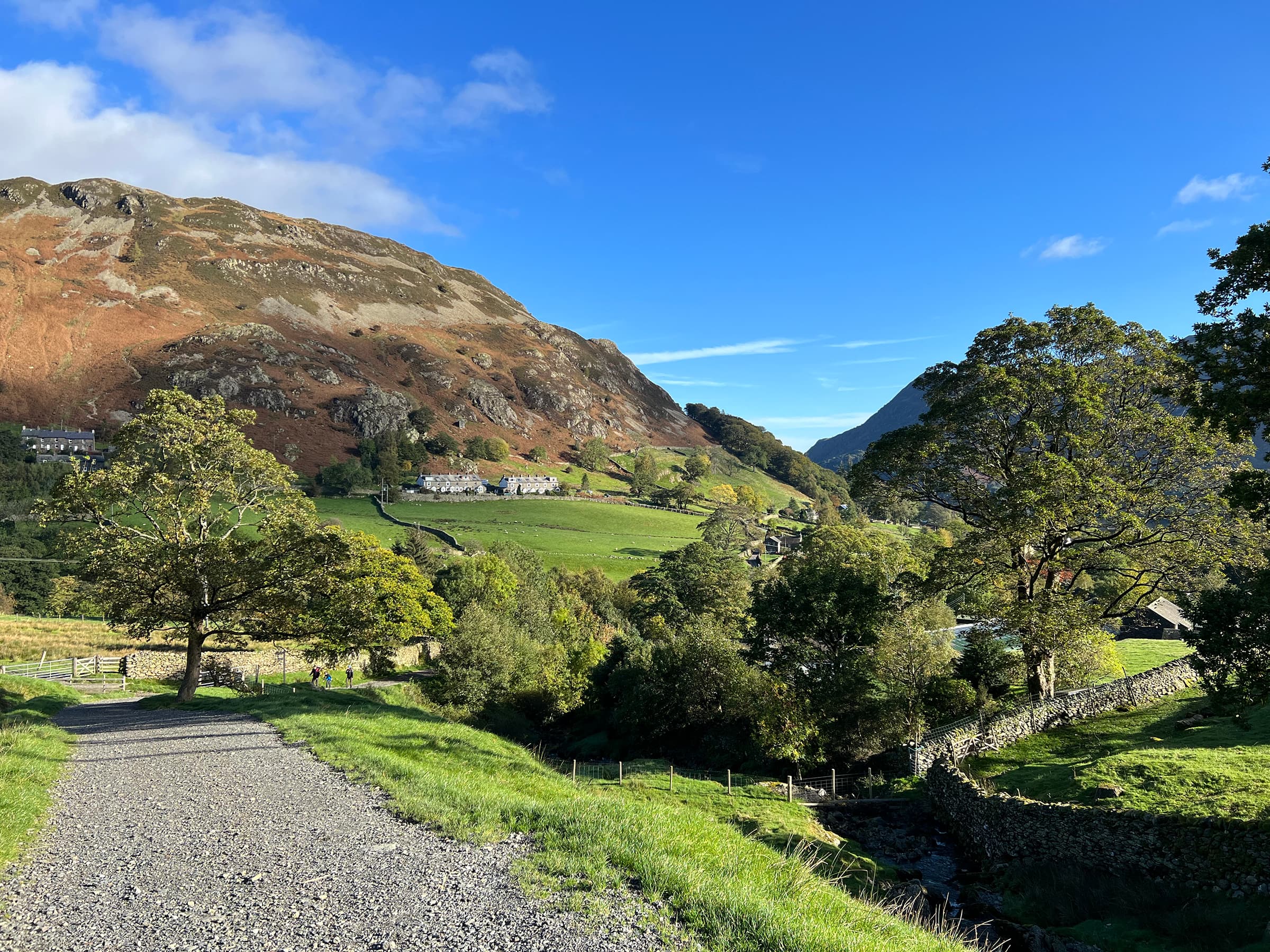
Glenridding
We began our hike in the small village of Glenridding, located at the southern end of Ullswater. Parking at the Pay & Display Glenridding car park (note: it’ll cost you 50 pence to use the public toilet), we headed up the road to Mires Beck, where the trail begins.
Coming from Shetland, with a vastly different landscape, the views were immediately incredible and, despite being October, the weather was exceptionally favourable.
Beck (n): a small stream, deriving from the Norse bekkr, ‘stream’
Lake District Archaeology: Romans and Vikings
Mires Beck
From here, the trail follows a well-maintained stone path alongside a stream (Mires Beck). Be prepared to climb. Although the path is well maintained, the stones only allow short, brisk steps, and it’s all up here, gaining 1,412 feet (430 metres) of elevation in just over a mile.
Mountain Forecast had predicted that the temperature would be cool, feeling like around -1, so we’d layered up. The layers came off during this segment of the hike.
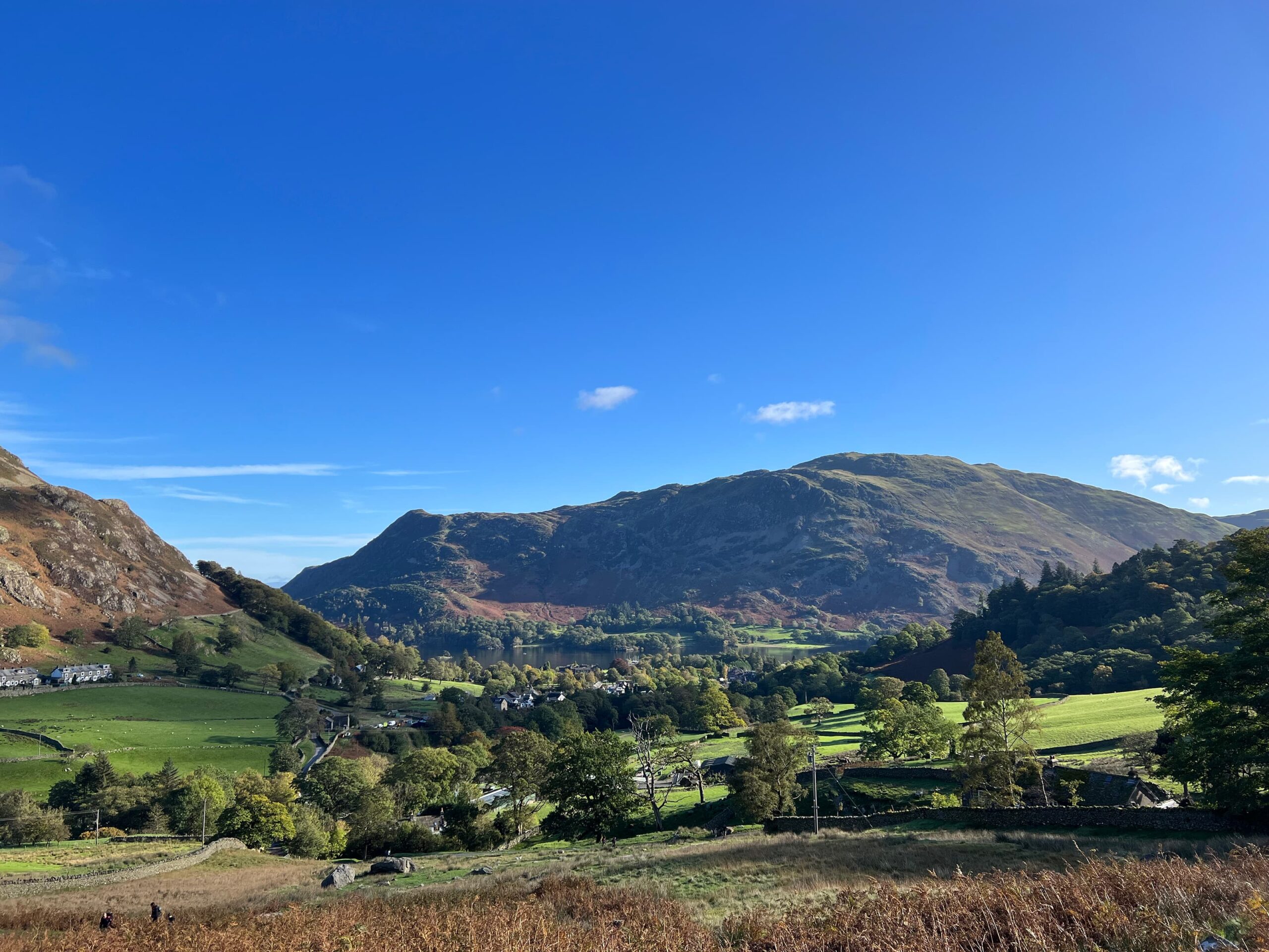
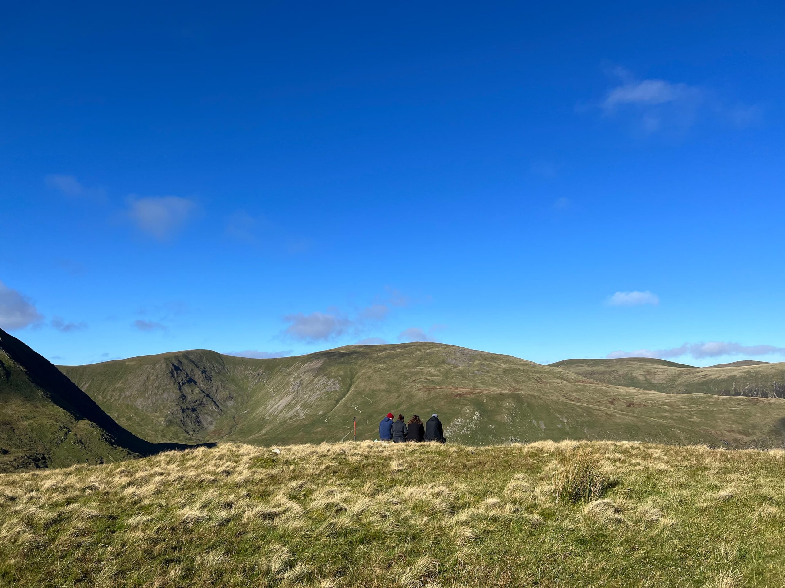
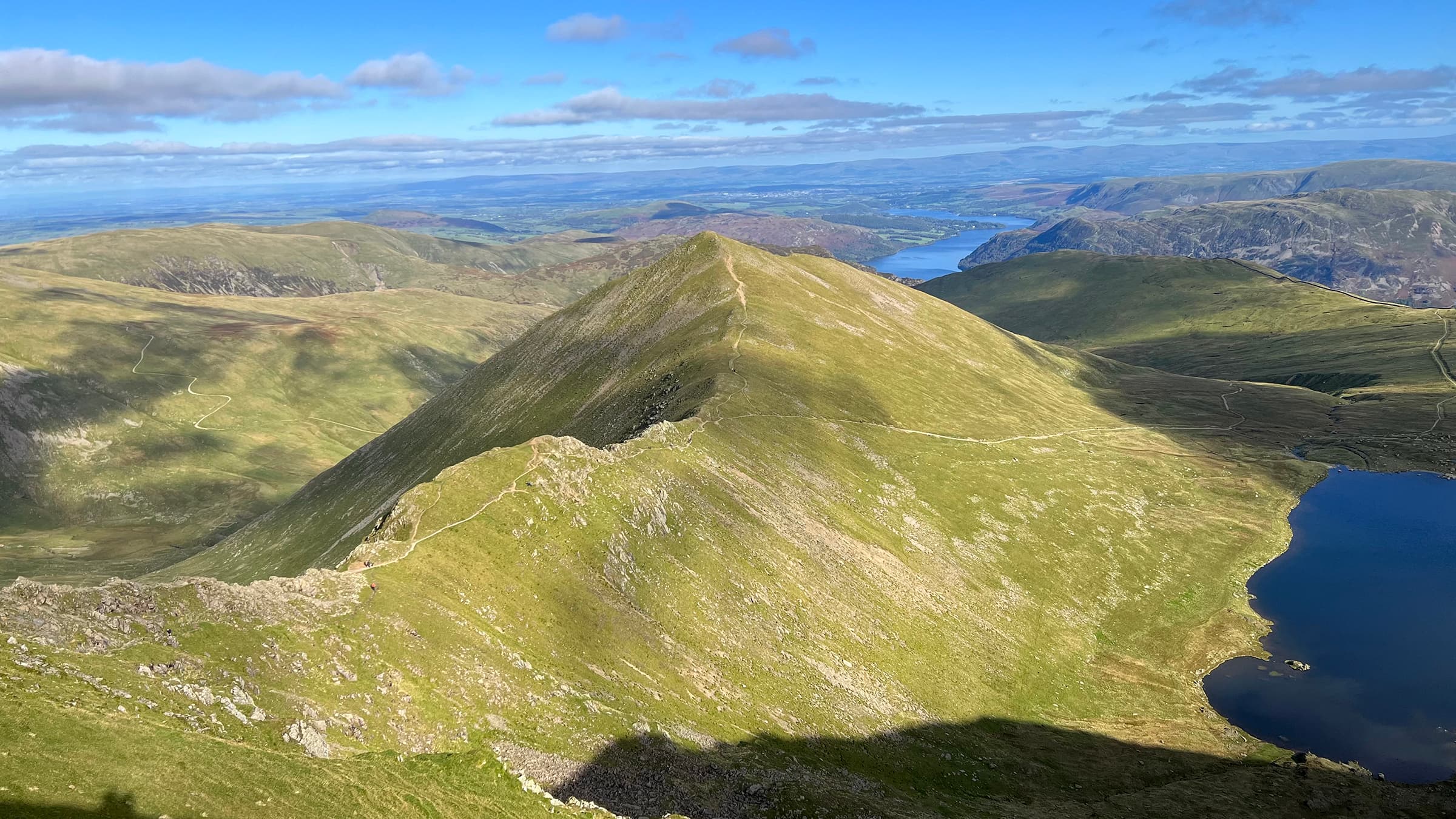
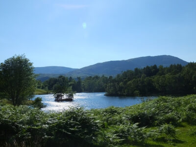
The elevation evens around 2.25 miles (3.6 km) into the hike, offering spectacular views of Ullswater and Place Fell (pictured below).
Moor (n): an open area of hills covered with rough grass, especially in Britain
The Cambridge Dictionary
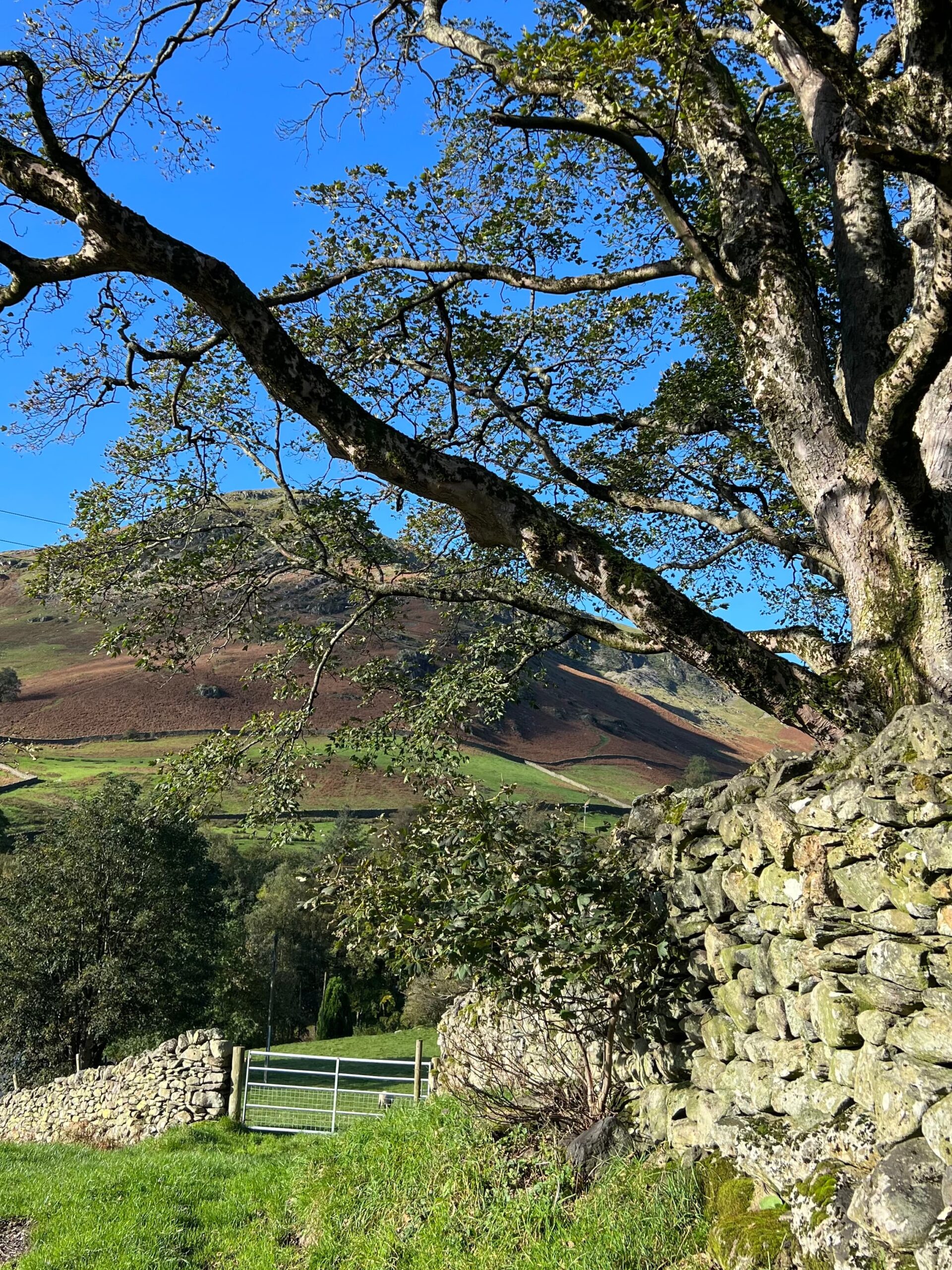
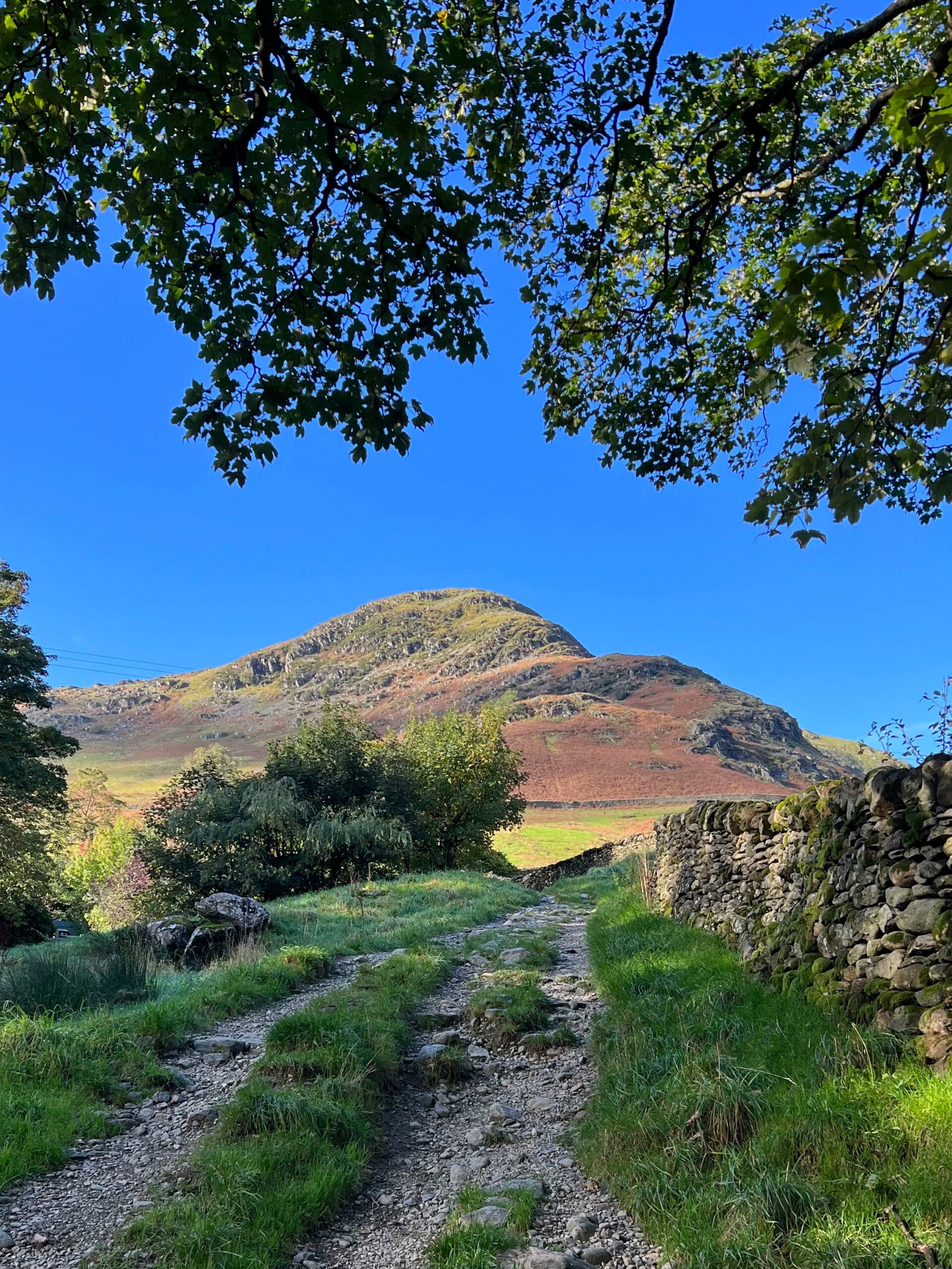
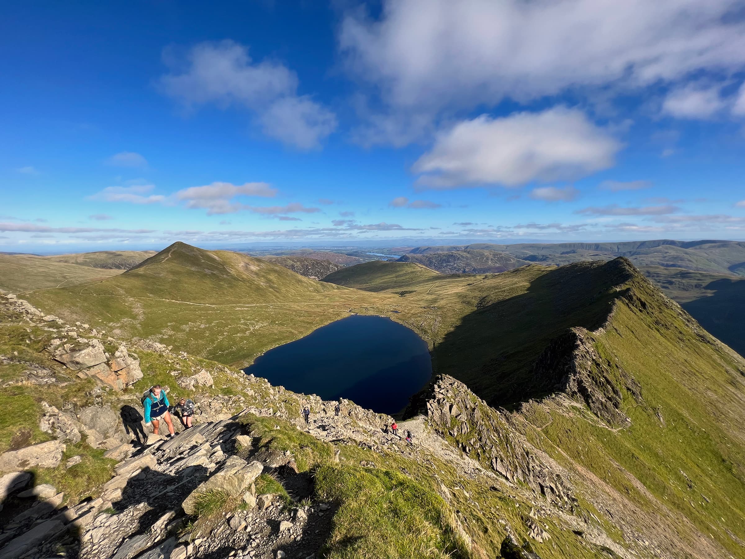
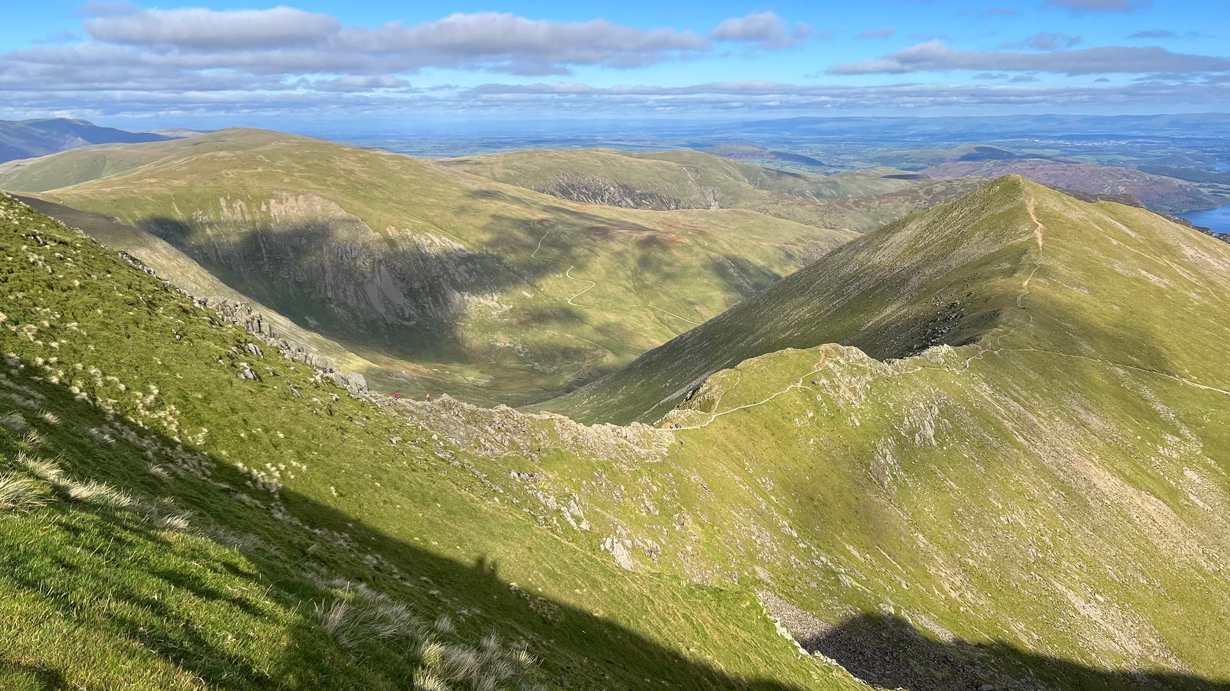
Birkhouse Moor
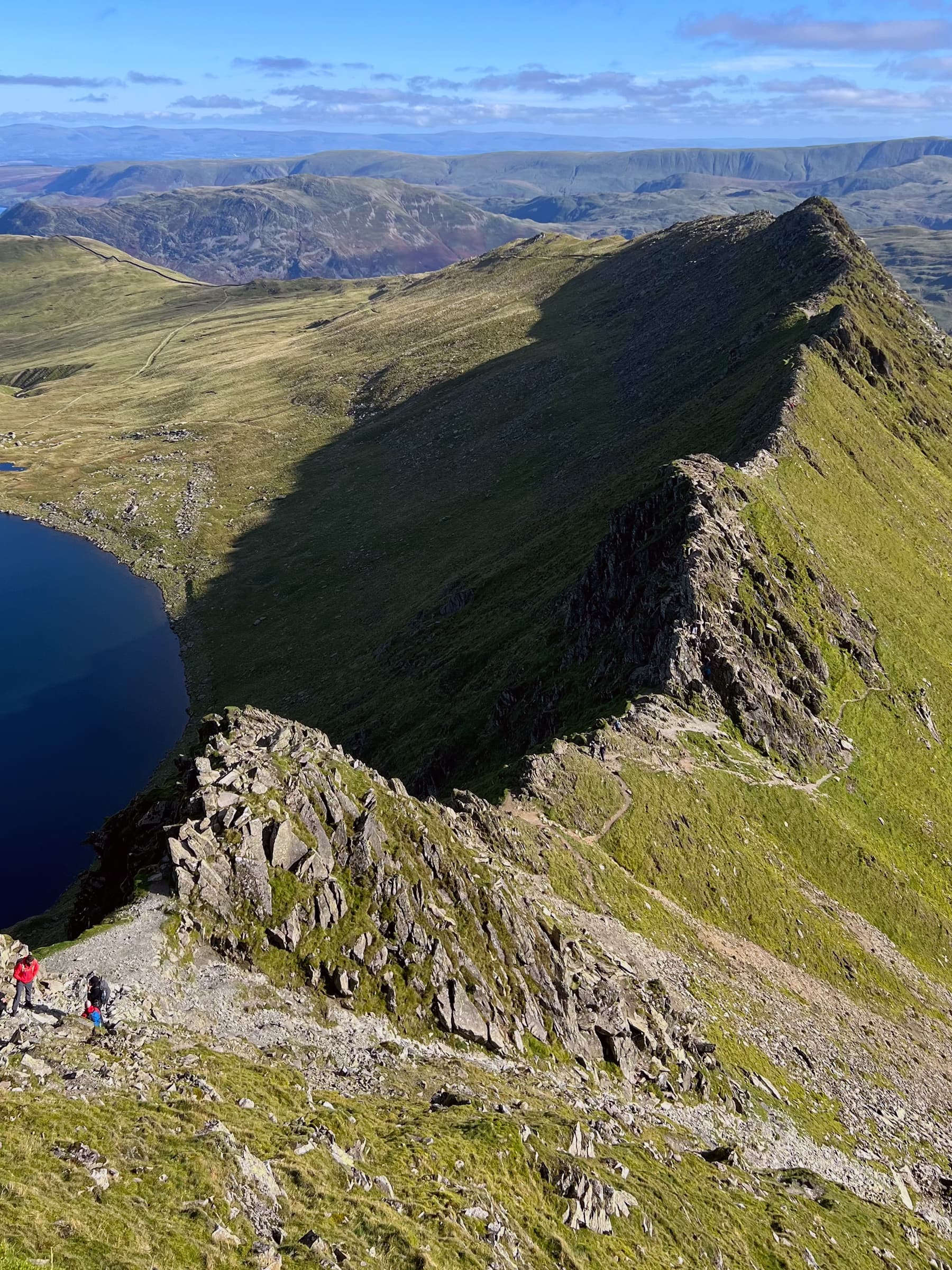
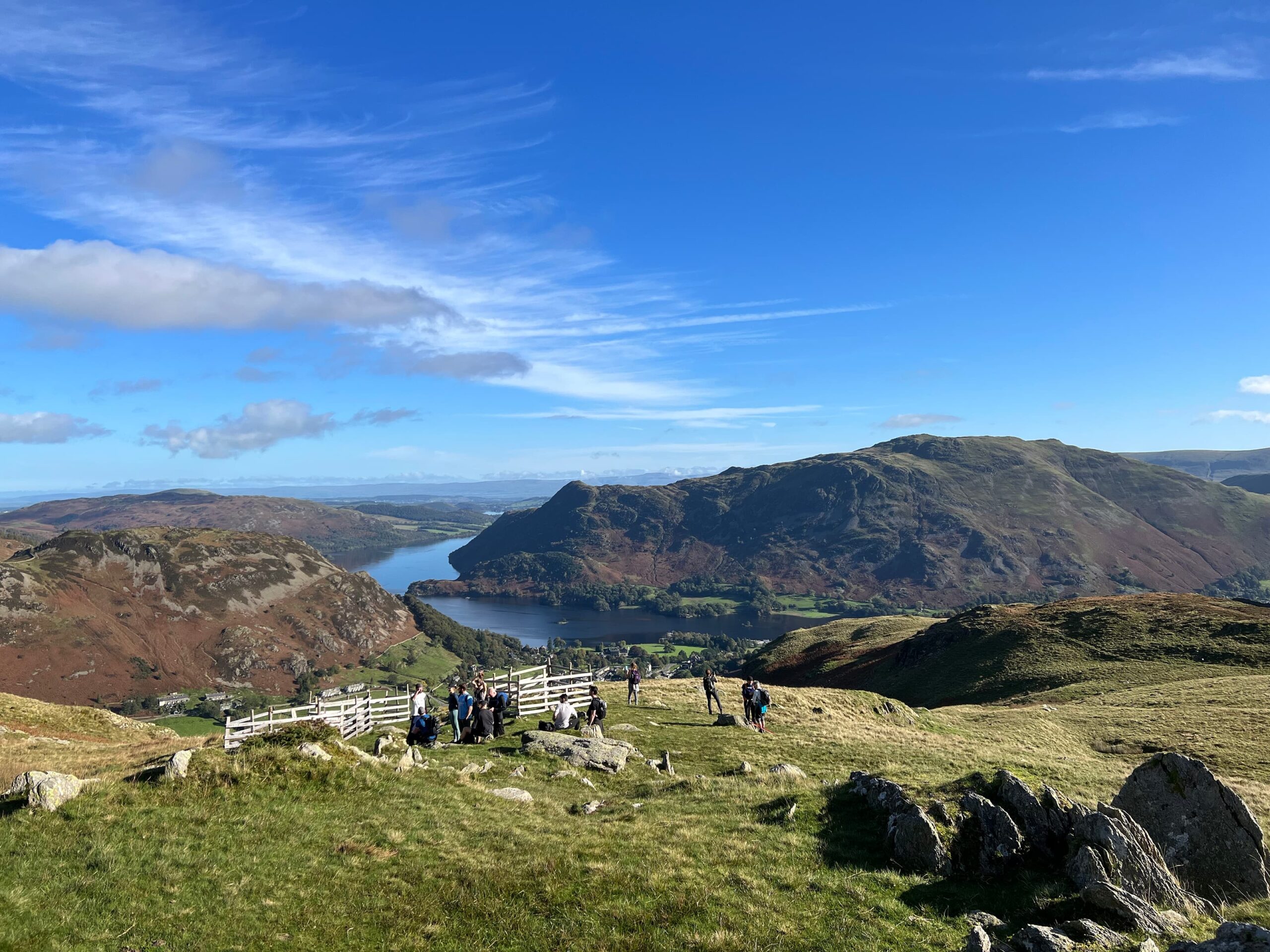
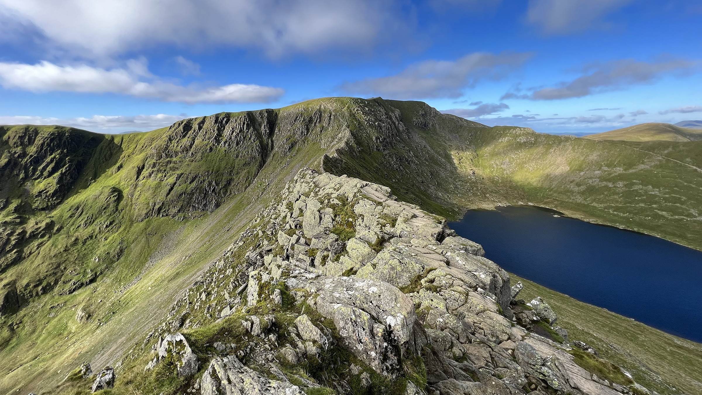
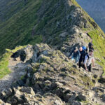
After a short break, we followed the path running alongside a drystone wall through Birkhouse Moor. It was here we had our first views (pictured below) of Striding Edge, Helvellyn, Swirral Edge and Catstye Cam flanking the not-yet-visible Red Tarn.
Hole in the Wall
Following the path takes you to the Hole in the Wall, a literal hole in the drystone wall with two wooden styles to cross, and the gateway to Striding Edge. In my excitement, I forgot to take a photo.
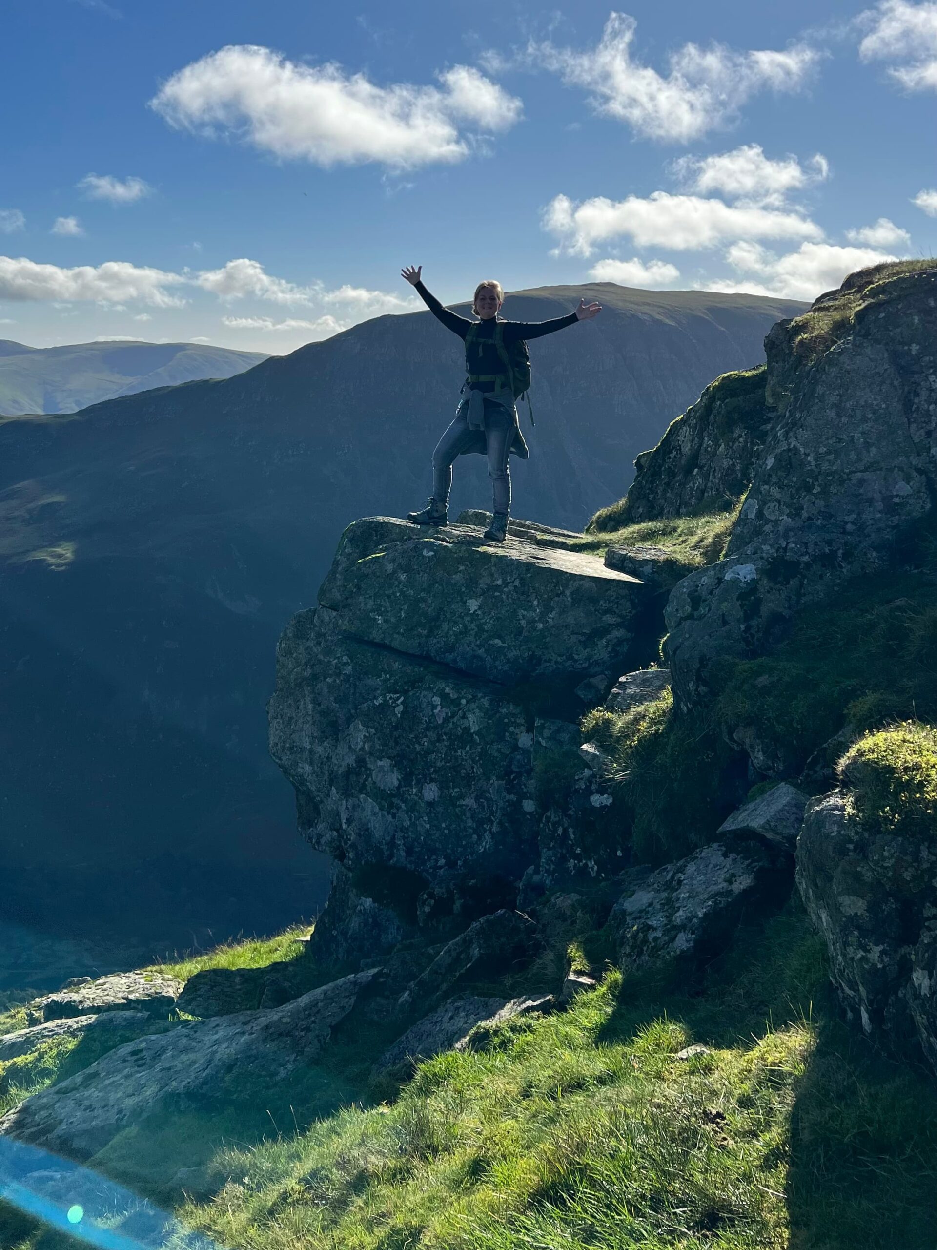
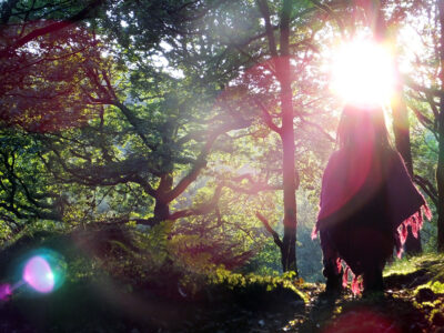
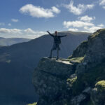
However, not too far from the Hole in the Wall, just before Bleaberry Crag there is a stone just begging to be stood on (pictured below). The view from here to the valley below is incredible, as are the hills in the distance.
Tarn (n): aka corrie, a small mountain lake in a hollow area surrounded by steep slopes formed by a glacier (UK).
The Cambridge Dictionary
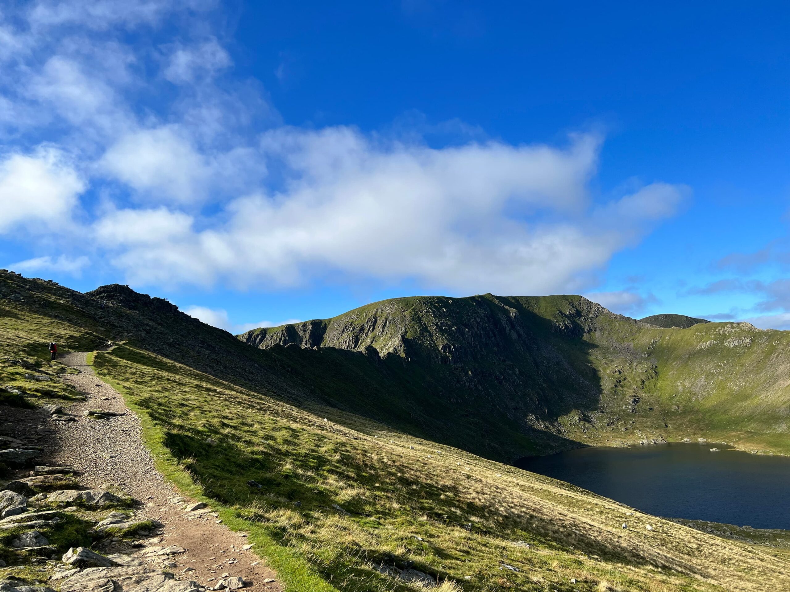
Red Tarn
Lying at an altitude of 3,567 feet (718 metres), with a depth of 82 feet (25 metres), the Red Tarn corrie is flanked on three sides by the steep slopes of Striding Edge, Helvellyn, Swirral Edge and Catstye Cam. It’s one of the highest lakes in the Lake District and was formed when the glacier that carved out Helvellyn’s eastern side had melted.
It may have been named Red Tarn because it was once coloured red due to the extensive mining of the high-grade iron ore, haematite, found nearby. Evidence of the old mines can still be seen in the north-facing valley beneath Swirral Edge.
Other sources say it’s called Red Tarn because of the colour of the surrounding scree.
In addition to brown trout, Red Tarn contains a rare fish called the schelly. It is one of only four lakes in the Lake District home to these fish.
Arête (n): a narrow ridge of rock that separates two adjacent glacier valleys.
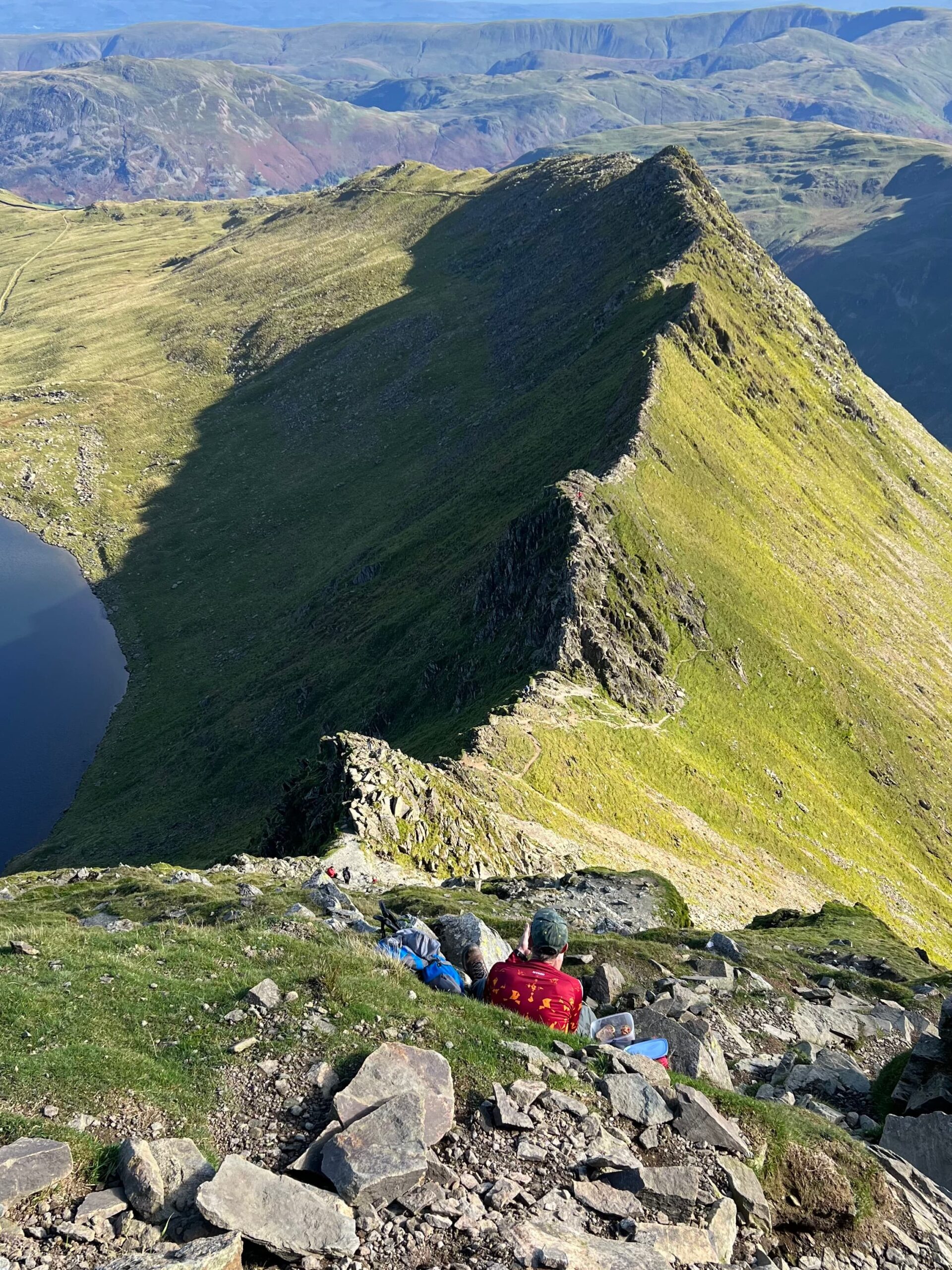
Striding Edge
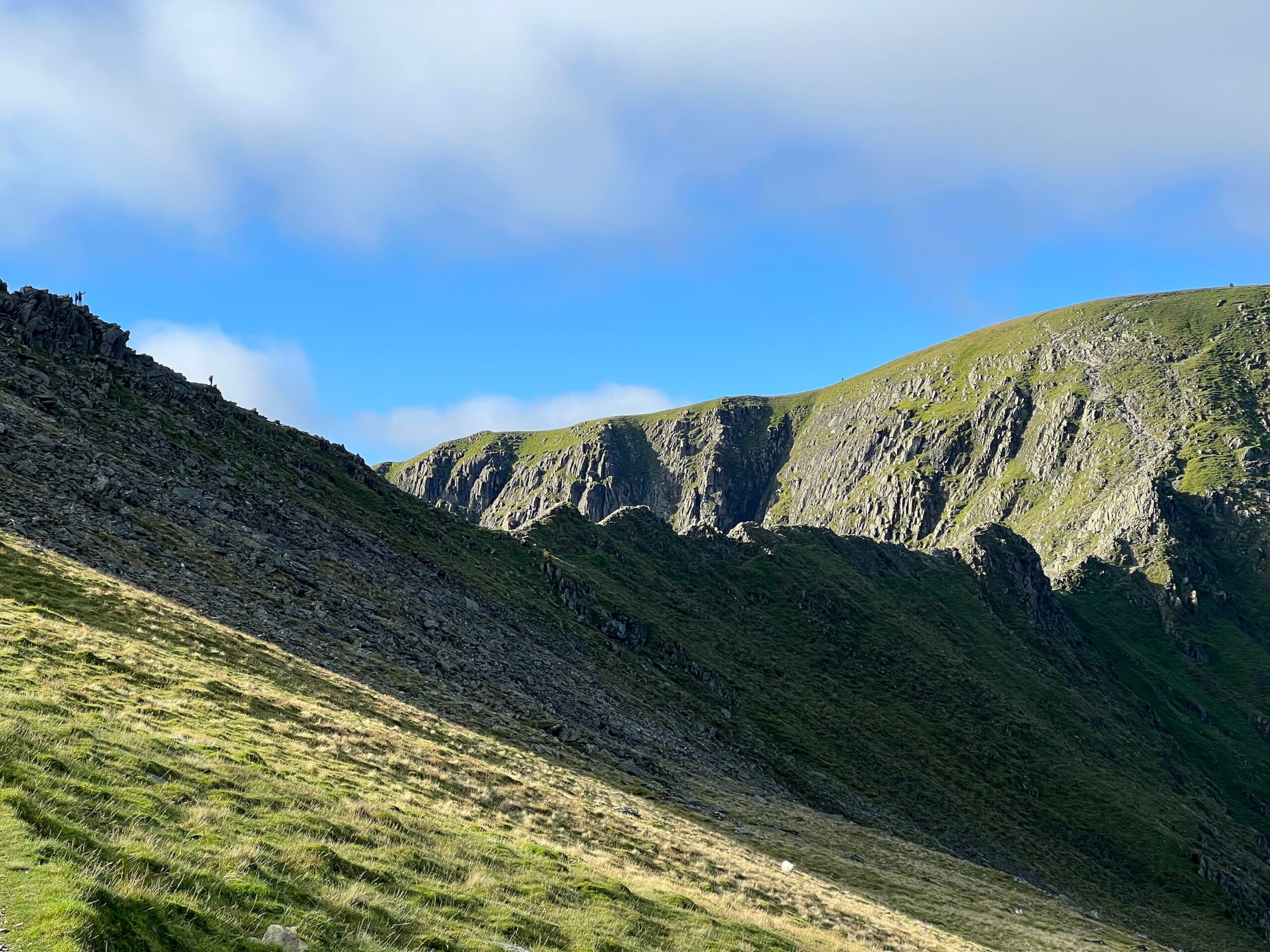
The stunning Striding Edge is a sharp arête, a narrow, rugged ridgeline resembling a serrated knife or saw blade. It has steep sides and a delicious one-mile-long (1.5 km) sharp crest, perfect for scrambling.
Formed during the last ice age, 20,000 years ago, Striding Edge used to be a local trade route between the villages Ambleside and Patterdale.
It is a classic Grade 1 Scramble and the most popular one in the UK, easily doable for competent hill walkers if the weather conditions are good. The narrow and exposed path can be intimidating, but a less-palpitations-inducing lower path is running alongside as a plan b.
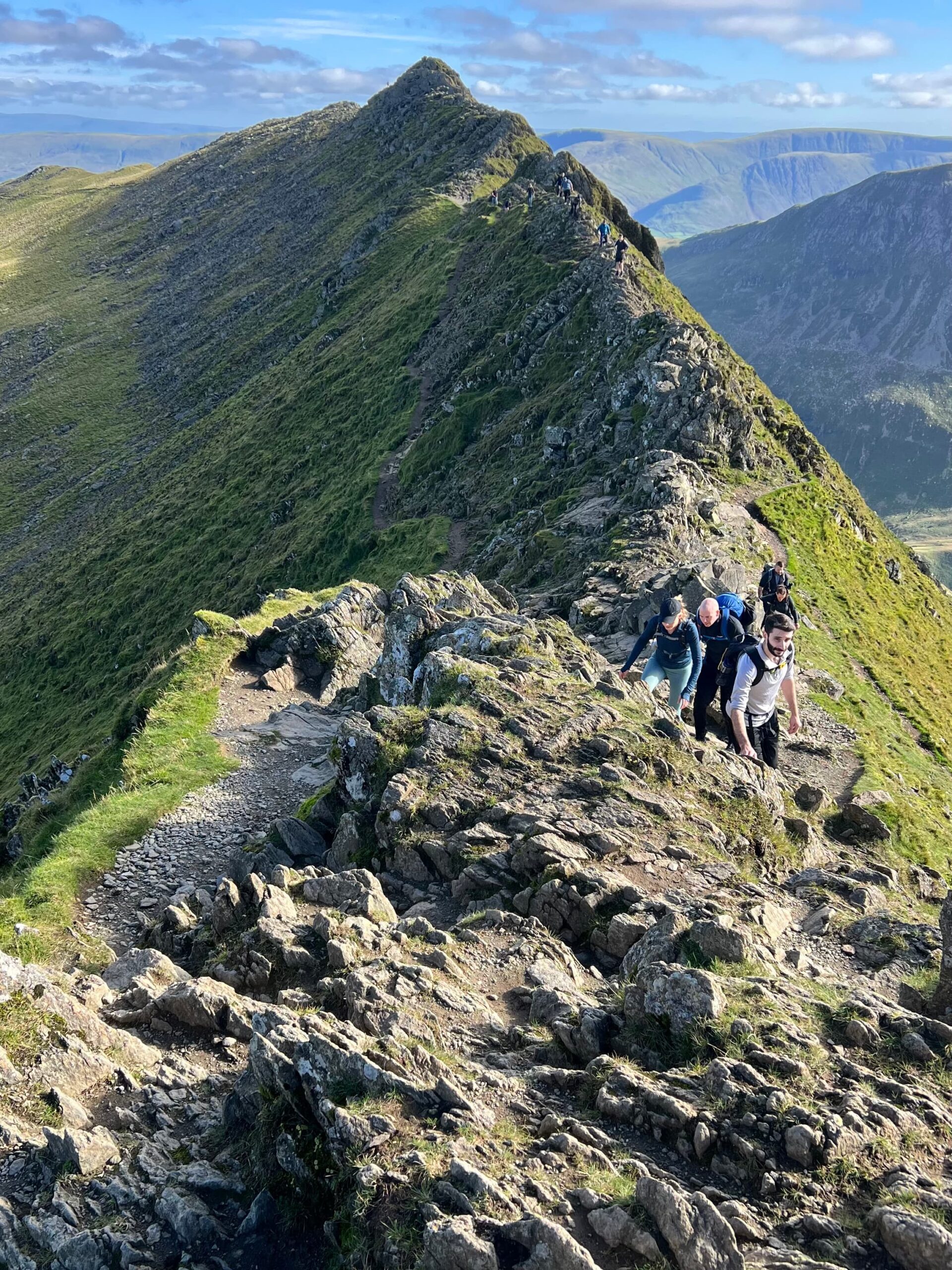
Midway along Striding Edge, you’ll encounter the Chimney, a 7-metre-high rock tower that requires a tactical downward climb.
From there, you’ll be faced with a path that is a scramble up a steep slope of loose shale and rock. This will take you onto the plateau with the Helvellyn summit and its trig point.
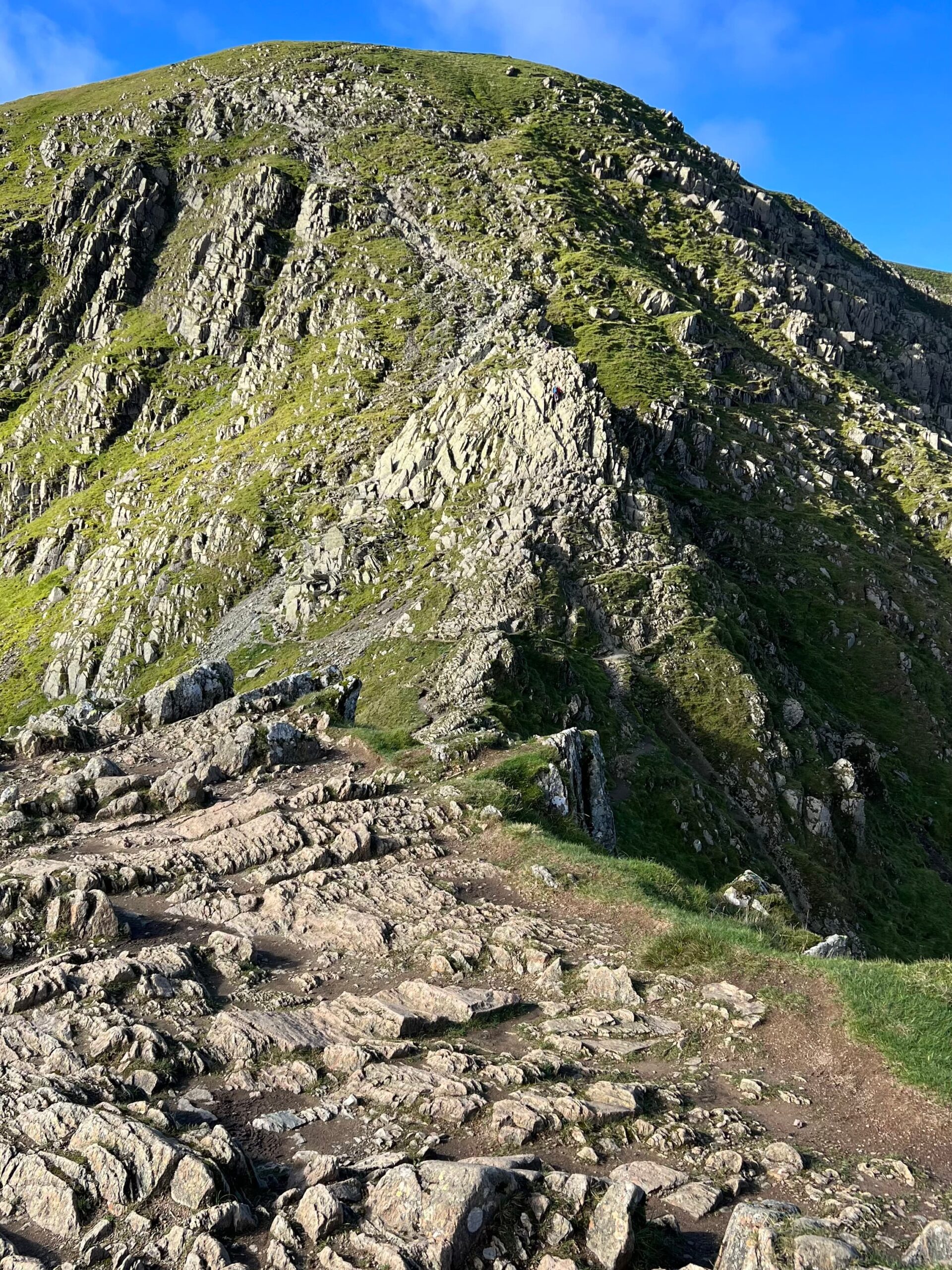
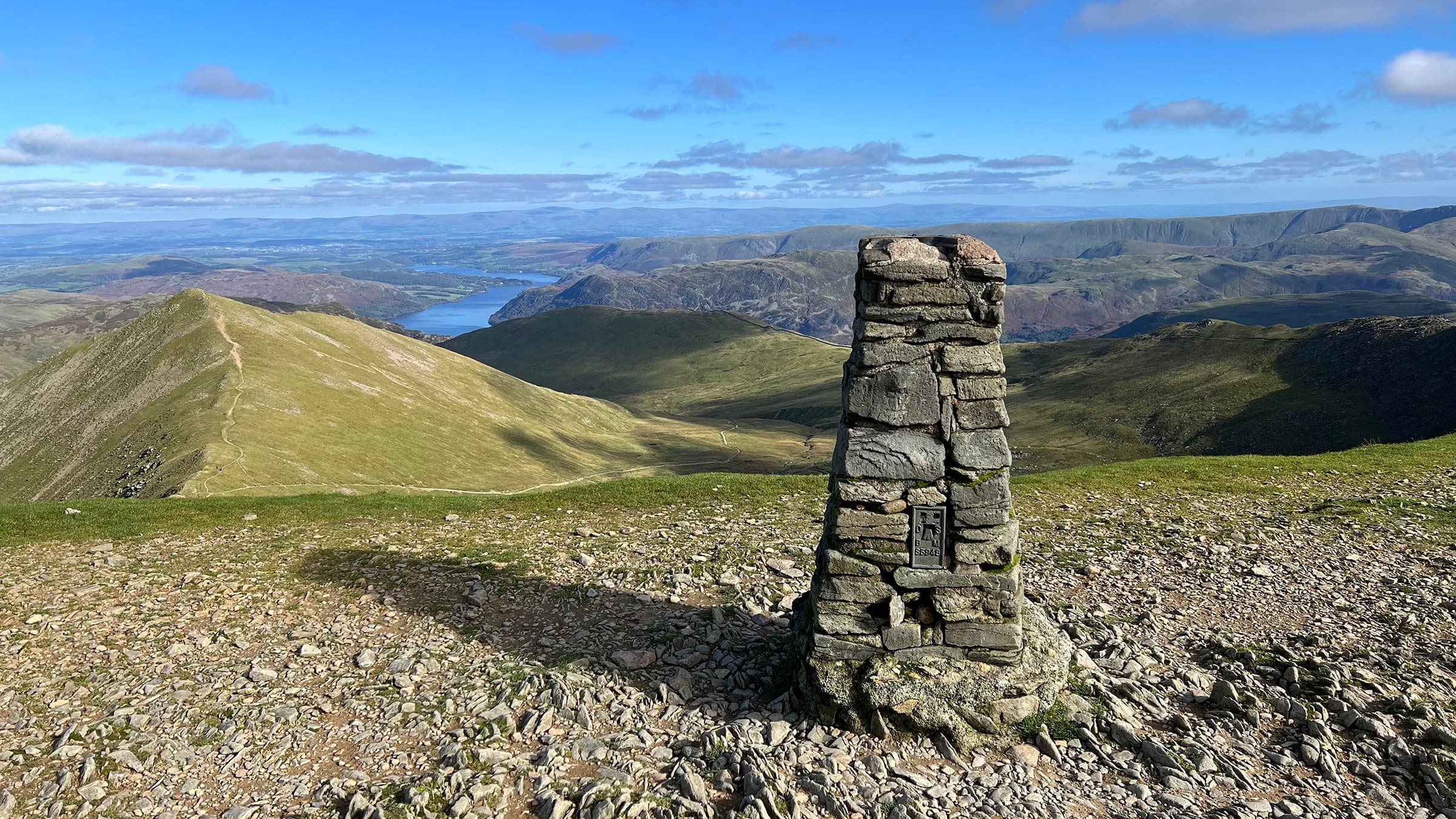
Helvellyn Summit
After the epic experience that is Striding Edge, reaching the summit of Helvellyn seems almost anti-climactic, especially given the crowds of people who have arrived via alternative routes.
Helvellyn, England’s third-highest peak, stands at 3,117 feet (950 metres). The broad plateau summit offers panoramic views across the Lake District.
The plateau is so broad that on December 22nd 1926, Bert Winkler and John Leeming landed an Avro 585 Gosport aeroplane on it. This was the first aeroplane to land on a mountain in Great Britain.
A cross-walled summit shelter stands just above Helvellyn’s east face, a welcome place to rest and refuel.
The mountain itself is made from volcanic rock, formed in the caldera of an ancient volcano about 450 million years ago.
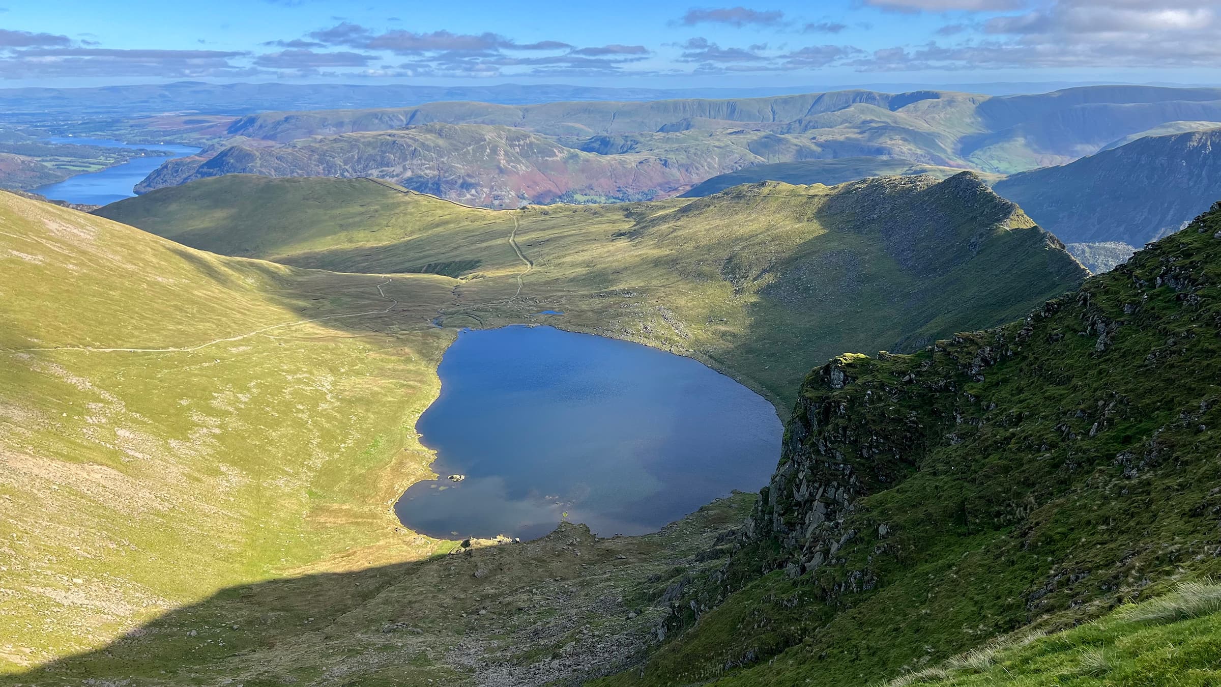
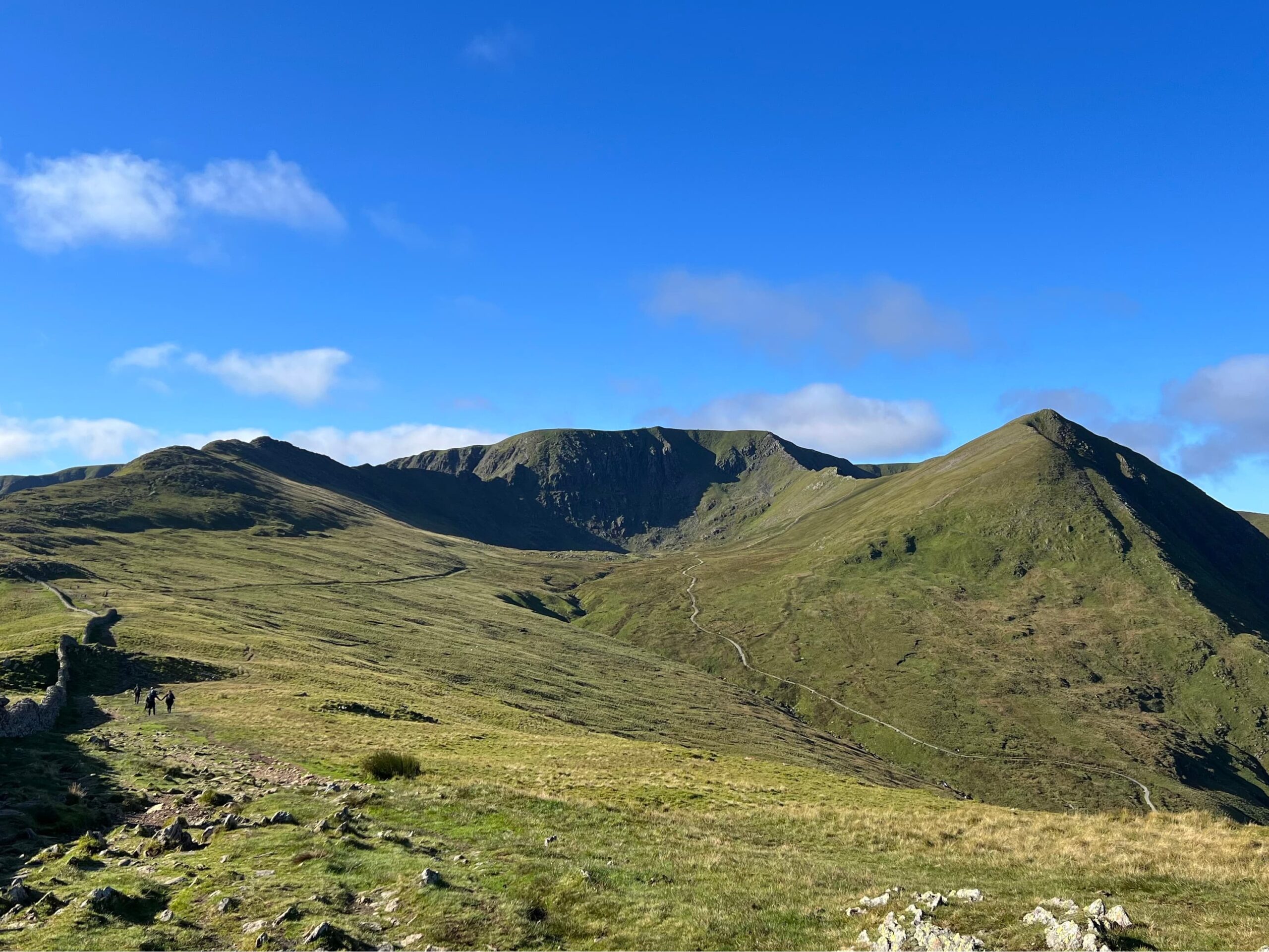
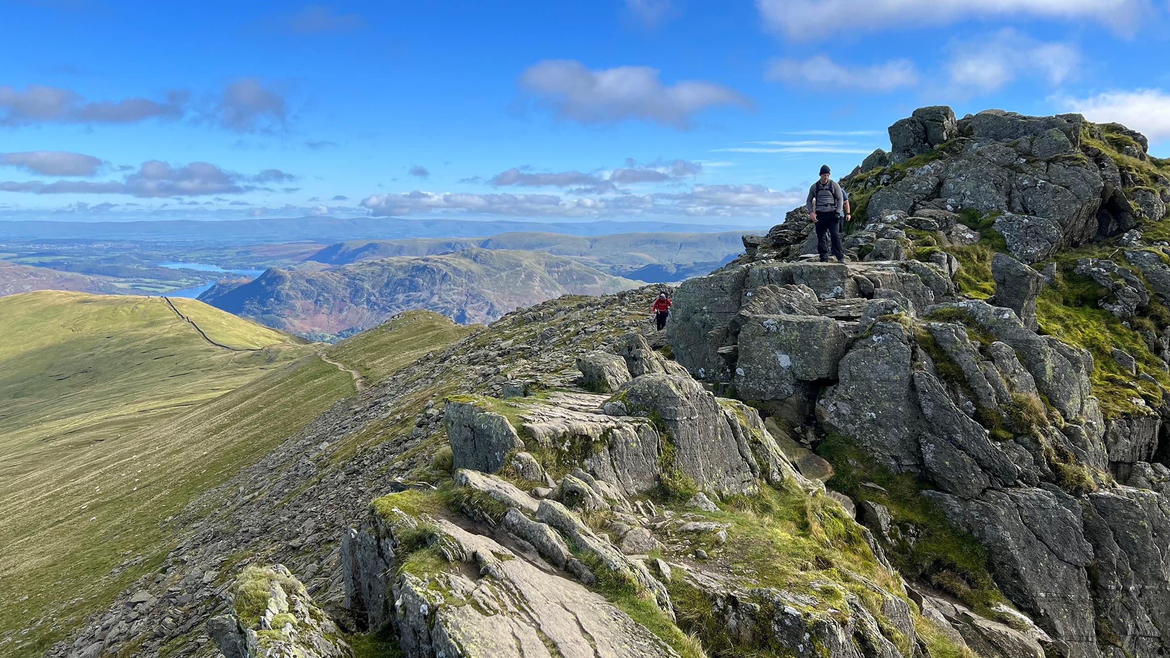
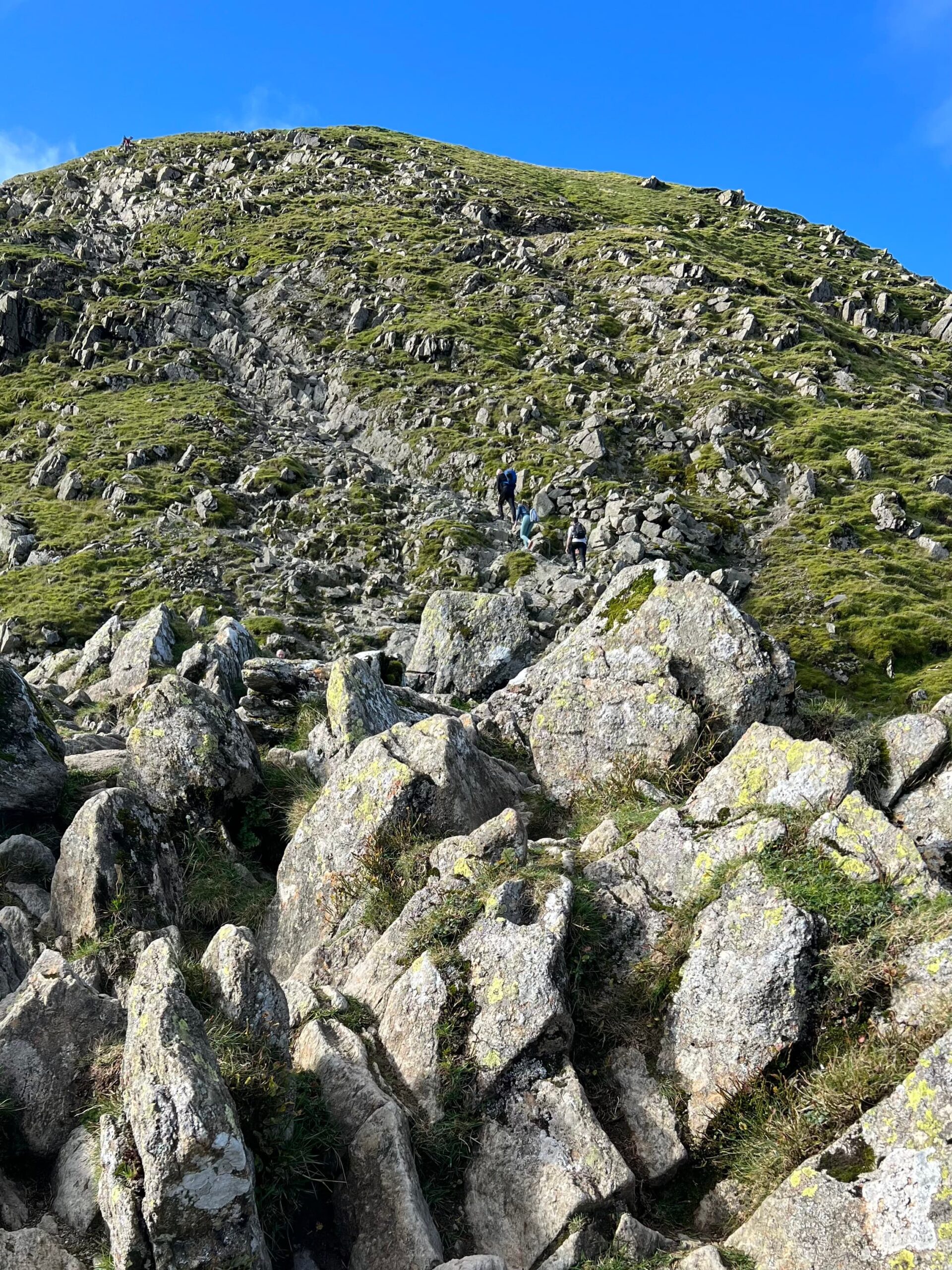
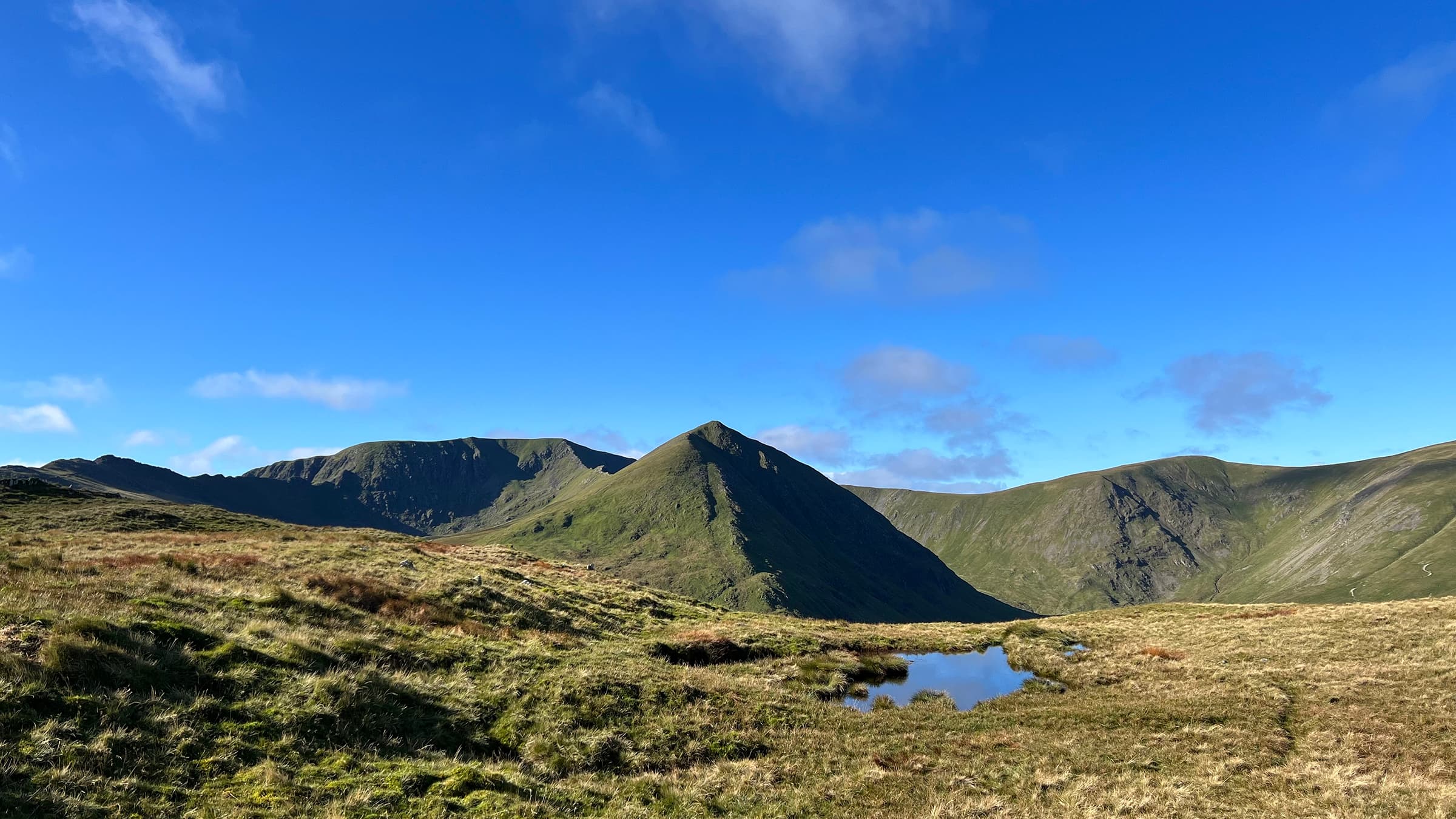
Swirral Edge
From here, we scrambled down from the plateau summit to Swirral Edge, pictured above.
Swirral Edge is an arête, the northern partner to Striding Edge, and although it is shorter at 500 metres, it still offers a tactical scrambling descent from Helvellyn.
The ridge overlooks Brown Cove to the north, where you can see evidence of previous dams and mining activity, and to the south it overlooks Red Tarn.
Catstye Cam
As far as mountains go, Catstye Cam, at 890 m (2,920 ft), is perfectly proportioned with its classic pyramid mountain shape. Doing this classic horseshoe walk without taking in its summit would be a shame.
The views are incredible, and it’s all downhill from here.
If Catstycam stood alone, remote from its fellows, it would be one of the finest peaks in Lakeland. It has nearly, but not quite, the perfect mountain form with true simplicity in its soaring lines, and a small pointed top, a real summit that falls away on all sides.”
Alfred Wainwright
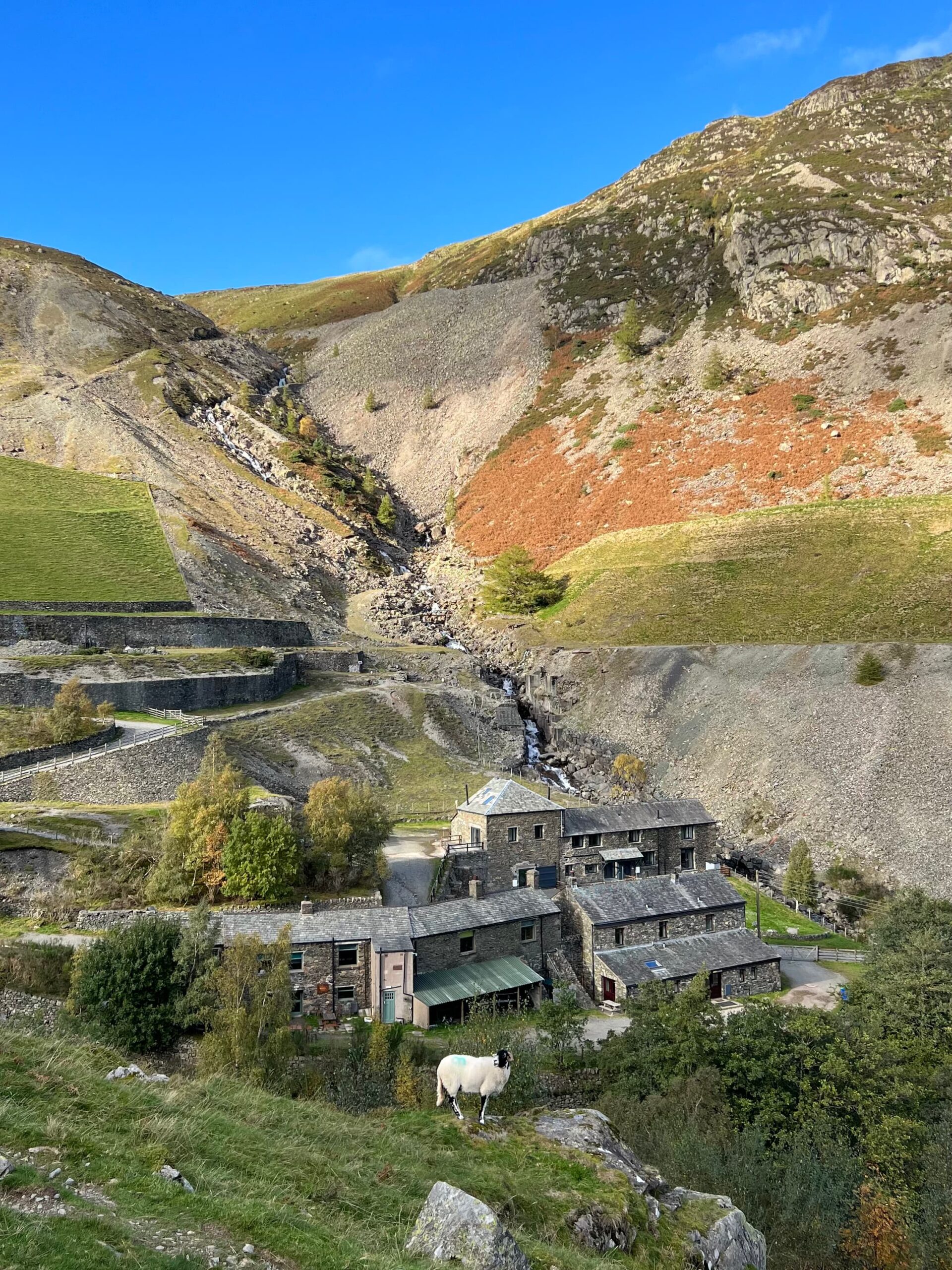
Greenside Mine
From the summit of Catstye Cam it was a pleasant downhill stroll. Following Red Tarn Beck, we headed north around the base of Birkhouse Moor.
Between 1825 and 1961, Greenside Mine produced over 159,000 tonnes of lead and 49 tonnes of silver. It was also the UK site of Operation Orpheus, a government experiment to test the seismic detection of large underground explosions.
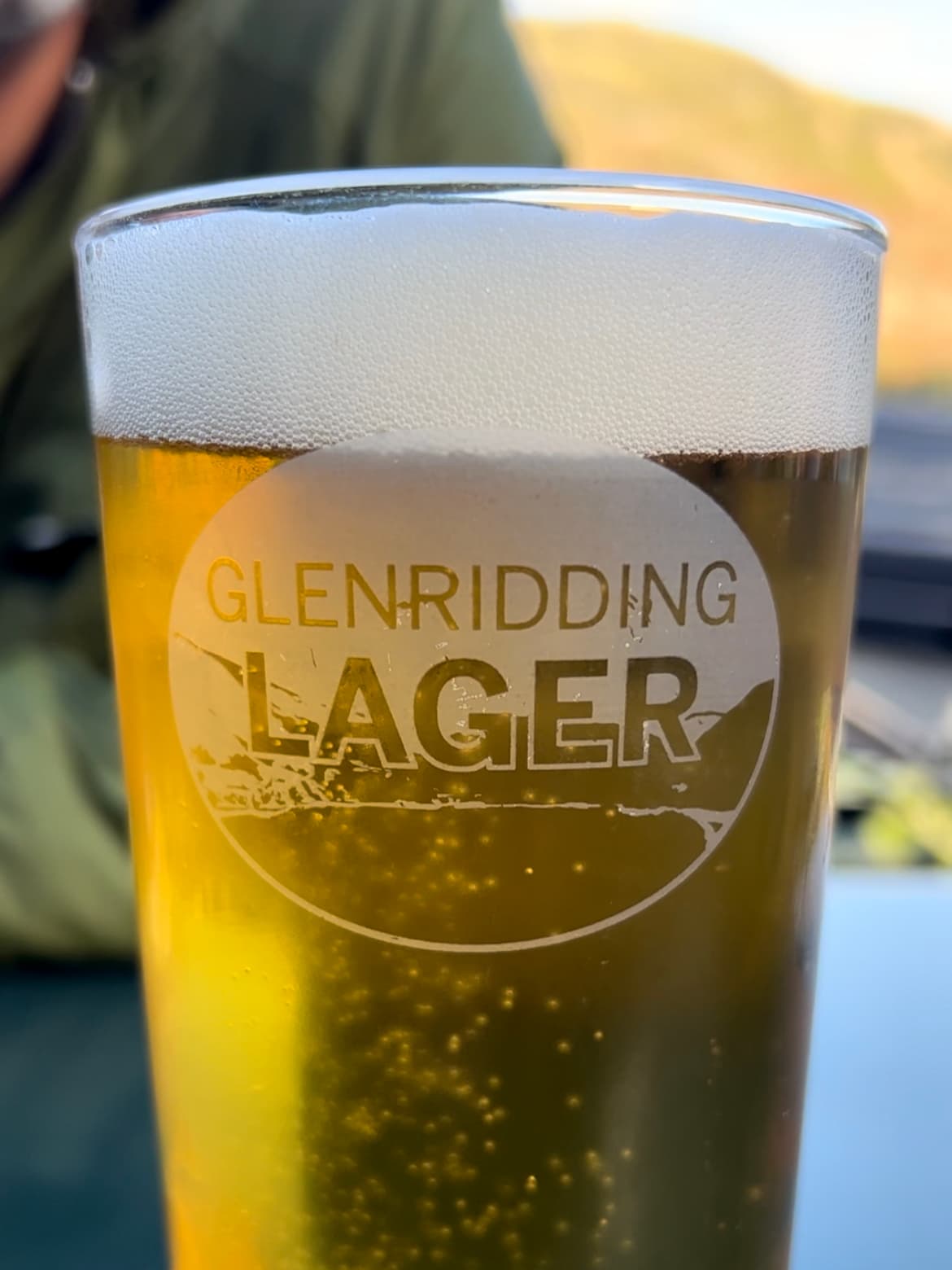
From here, it’s a gentle walk back down to Glenridding, where a well-earned pint can be had.
 Pan-seared Scallops & Langoustines with Stir-fried Vegetables
Leave a Reply